
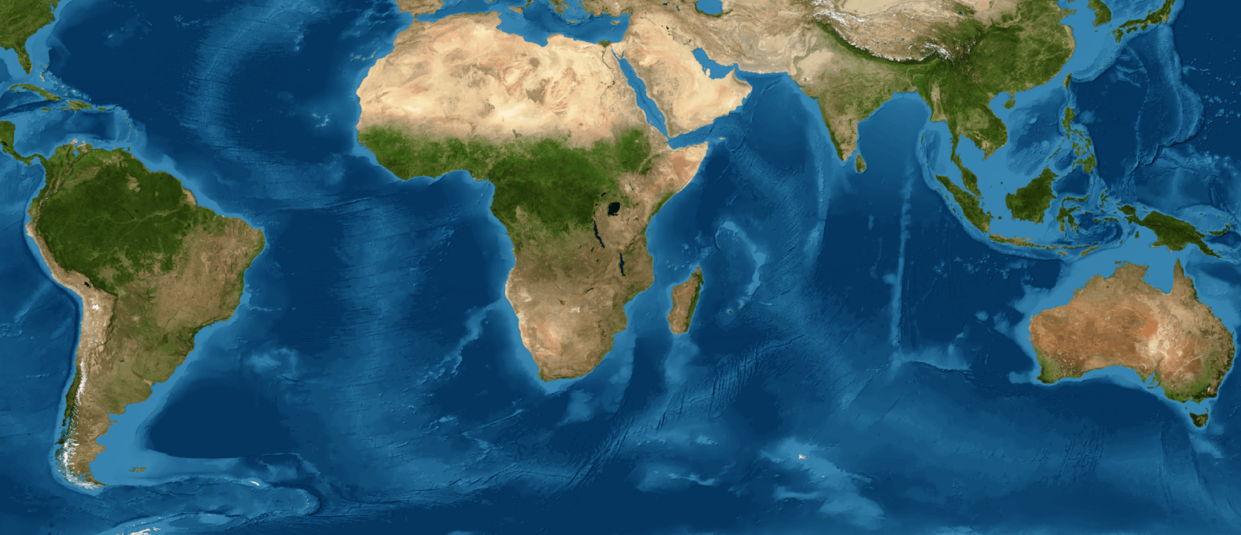
The Venezuelan territory went from having 852,836 km² of vegetation cover in 1985 to 812,744 km² in 2024, representing a net loss of 40,092 km² in the country's total vegetation over 40 years.
These data are part of the launch of the Beta Collection of new datasets from MapBiomas Venezuela: the Vegetation Loss and Secondary Vegetation modules, presented this Friday, March 27, during the webinar “Vegetation Cover Change Trajectories in Venezuela (1985-2024).” This collection of annual maps, part of the platform's Land Cover and Land Use data, reclassifies the information into 3 new classes: natural vegetation, anthropogenic cover, and other covers that are not part of the vegetation cover dynamics. Then, the cover change routes derived from the vegetation cover change trajectory model were identified, which are analyzed in the vegetation modules. Webinar “Trayectorias de cambio de la cobertura vegetal en Venezuela (1985-2024).” Esta colección de mapas anuales, parte de los datos de Cobertura y Uso del Suelo de la plataforma, reclasificando la información en 3 nuevas clases: vegetación natural, coberturas de origen antrópico y otras coberturas que no forman parte de la dinámica de la cobertura vegetal. Luego, se identificaron las rutas de cambio de la cobertura derivadas del modelo de trayectorias de cambio de la cobertura vegetal que se analizan en los módulos de vegetación.
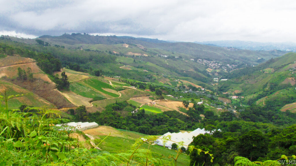
These modules facilitate the study and analysis of vegetation cover change trajectories in Venezuela, allowing for the quantification, since 1985, of natural vegetation (without anthropogenic alteration), secondary vegetation (i.e., the product of natural recovery and establishment of secondary vegetation after human intervention), and vegetation cover loss (both natural and secondary).
The data from these new collections are publicly and freely available, allowing anyone to access valuable information about changes in the Venezuelan territory. Among the results presented, we can highlight that:
- 76.0% of the national territory is vegetation cover. Of that percentage, 6.0 % corresponds to secondary vegetation.
- The area of secondary vegetation is notably larger north of the Orinoco River, at 20.3 %, in contrast to the south, where it only represents 0.3 % of the total vegetation cover.
- Contrasting patterns of vegetation cover loss occur north and south of the Orinoco River: in the last two decades, in the north, re-intervention or loss of secondary vegetation is frequent, accounting for 65% to 67% of the total vegetation loss; while south of the Orinoco River, the loss of natural vegetation is more significant, representing between 82% and 75% of the vegetation cover loss in southern Venezuela. That is, re-intervention dominates in the north and loss of natural vegetation is more prevalent in the south.
The publication of this data and access to these new modules will allow users to identify intervened areas and natural recovery areas over the 40-year time series, also serving as a tool that can drive public policies and proposals for sustainable land management.
About MapBiomas Venezuela
MapBiomas Venezuela is an initiative co-created by Provita, Wataniba, the Laboratory of Geographic Information Systems and Environmental Modeling of the Simón Bolívar University (LSIGMA–USB), and the Amazonian Network of Georeferenced Socio-Environmental Information (RAISG) in collaboration with specialists from various NGOs, universities, and research centers in the country, organized by themes and regions.